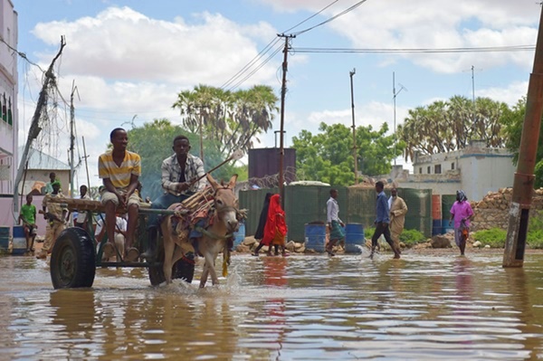
 Flooding in the Beledweyne city of Somalia in 2016. ©AMISOM Public Information.
The International Day of Action for Rivers is marked on 14 March every year to celebrate and create awareness about the importance of rivers. Read on to know about one of DHI’s recent river-related projects to improve flood management in Somalia, East Africa.
--------------------------------------------------------------
The Shabelle and Juba River basins are the only two perennial rivers in Somalia sustaining water supply, including water for agriculture. Despite its potential, the Shabelle River basin tends to shift dramatically from flooding to drought due to challenges in water management.
Somalia’s Ministry of Energy and Water Resources (MOEWR) in collaboration with the United Nations Environment Programme (UNEP) is carrying out the project ‘Sustainable Flood Management and Risk Reduction Action’, ongoing from August 2021 to March 2022. The project is funded by the Foreign, Commonwealth & Development Office (FCDO) and also involves the Food and Agriculture Organization of the United Nations (FAO).
Nature-based Solutions to flood management
Under guidance of the MOEWR, UNEP is undertaking the project’s research component and the UNEP-DHI Centre is providing the technical inputs to assess the potential of nature-based solutions (NbS) in mitigating flood and drought hazards. The direct beneficiaries of the findings and tools are the National Flood and Drought Task Force members including members from Hirshabelle, Jubaland and Southwest states.
The project’s study areas are the Shabelle River basin and key urban centres –Beledweyne, Jalalaqsi, Bulo Burde, Mahaday and Jowhar; and as a pilot case, the flash flood affected areas of Qardho, in Puntland State and also Beledweyne in Hirshabelle State.
Modelling tools and earth observation methods
The project investigated measures such as reforestation, terracing and sand dams in mitigating flash floods impacts in the ephemeral rivers or wadis, using modelling tools and earth observation-based indicators. In the case of riverine floods in the Shabelle River, a mathematical model of sediment transport was established to explore the natural behaviour of the river, determining when and where erosion and deposition occurs.
Next, a model was used to study the effect of planned NbS interventions and to provide sediment related indicators for prioritised actions. The interventions analysed are vegetated gabions and embankment revegetation, and reforestation/gully rehabilitation. Due to data limitations, exact numbers and locations cannot be extracted from the models, but trends and characteristic behaviours can be determined. This is essential to inform next steps and to make recommendations on top priority data collection efforts.
Most of the data used in the study is available at www.jubashabelle-tmo.org. Final findings and recommendations are currently being submitted for revision to the MOEWR and Task Force members. For more information, contact Sílvia Leirião, project team leader at DHI, or Maija Bertule, senior technical advisor at the UNEP-DHI Centre.
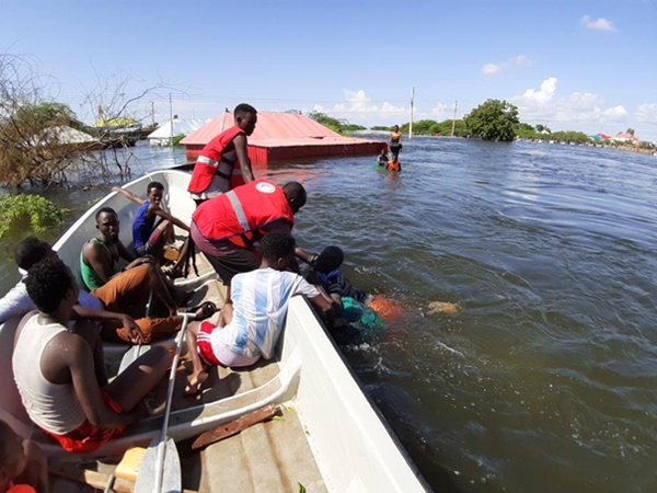
Somali Red Crescent workers providing assistance to flood-affected communities in May 2021. ©Somali Red Crescent