In Bangladesh, two-thirds of the coastal land has an elevation of less than three metres, often leading to devastating flooding during cyclones in the Bay of Bengal. With the severe climate changes happening, it is foreseen that flooding will occur more frequently and with bigger human, environmental and economic impact. That’s a huge risk to the 30 million people living in polders – land enclosed by embankments. These low-lying plots of land were constructed in the 1960s and 1970s to protect farmers from saline water intrusion and the impact of storm surges. But today, the polders are not fit for the future.
A new study commissioned by the Bangladesh Water Development Board (BWDB) with funding from the World Bank will focus on developing a sustainable solution for polders in Bangladesh. The project will last 30 months and will have intense local presence by all international and local experts. DHI (Denmark) and Deltares (Netherlands) are leading the study in association with the Institute of Water Modelling (IWM - Bangladesh), University of Colorado (USA) and Columbia University (USA).
‘We now experience how the climate changes disrupt people’s livelihood. We can only solve these complex water challenges if we work across functions, geographies and cultures. I’m therefore also confident that we, with this set-up, will create a solution that can secure the many people living in polder areas a life without fearing being flooded and seeing their homes and livelihood disappear’, says Kim Wium Olesen, project manager at DHI.
Deltares’ project leader Alessio Giardino shares, ‘It will be a unique occasion to work together with one of the most knowledgeable and multidisciplinary teams worldwide. I hope that the combination of state-of-the-art modelling software, monitoring techniques, and physical and socio-economic expertise will form the basis for a better understanding of the extremely complex Bangladesh delta and polder dynamics. Thereby, providing the basis for the development of resilient and sustainable polders and a better life for current and future generations.’
Understanding large-scale dynamics
The aim of the project is the development of a clearer understanding of the relationships between the functioning of the polders and the ever-changing large-scale drivers such as human impact on the environment across the entire river basin and changes in climate.
State-of-the-art numerical models will be implemented at different scales in combination with innovative monitoring techniques to quantify hydrodynamics, sediment load and subsidence rates across the Bangladesh Delta. This will form the basis for the development of conceptual polder designs and sustainable management plan as well as for the setting up of a long-term investment plan for implementation of the proposed designs and management improvements.
An important component of the project will also be the building of analytical foundation and technical capacity at BWDB, local research organisations and local communities, to engage in science-driven decision for better and more sustainable decision-making.
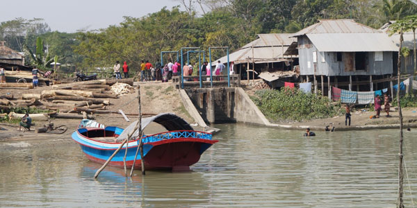 Polders – land enclosed by embankments – were constructed in Bangladesh in the 1960s and 1970s to protect farmers from water intrusion and storm surges impacts. But they’re not made for the future. © Deltares